Outside in Carter County Tennessee
Photos | Resources | Weather | Hiking | Roan Mountain | Elizabethton | Scots-Irish | Watauga Lake | Home | Virtual Hike | Wildflowers | Wallpaper | About/Contact
Waterfalls of Carter County Tennessee
The geography and climate of the Appalachian region produce many fast running streams and rivers. Whitewater, cascades, and waterfalls are the natural result. Carter County is blessed with a number of scenic waterfalls, including Laurel Falls, the Blue Hole, Coon Den Falls, Jones Falls, and Twisting Falls. Nearby across the North Carolina state line is Elk River Falls.
Waterfalls are beautiful. Waterfalls are deadly. More than one person has been killed or seriously injured at local waterfalls. Typically there are multiple emergency rescues every year. Climbing on the wet rocks of a waterfall is extremely risky. The currents underneath falling water can roll you down and under quickly. One poor fellow rolled around for a day at the base of Laurel Falls before his body could be fished out. Tourists have fallen to their death after trying to take a photo. These are just a couple examples. Every waterfall has stories of injuries. Don't become one.
The Blue Hole
The Blue Hole is located at the base of Holston Mountain near Stoney Creek. It's reached by turning on to Panhandle Road off Hwy 91. Shortly after the pavement turns into a gravel Forest Service road, there is a small parking area on the left. Walk down the hill and you can't miss it. This is a popular local gathering spot in the summer and best visited at off peak times. For an adventurous drive, the gravel road will take you to the top of Holston Mountain which reaches 4,285 ft(1306m). Holston Mountain has a network of trails covering the ridge and running off both sides. South Holston Lake can be seen from the mountain top. Several local broadcasters have antennas on Holston as it is the highest point central to the Tri-Cities.
This series of Blue Hole photos was taken on a cool March day when a stray snow flurry was blowing through.


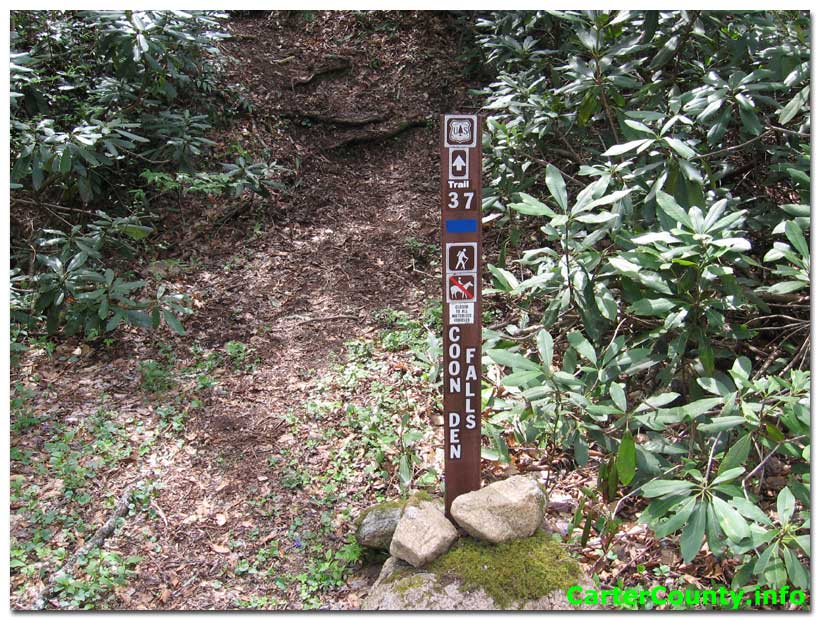
Coon Den Falls or Bear Cave Falls
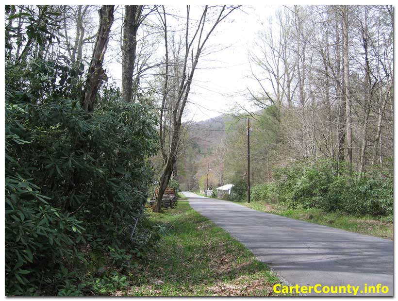
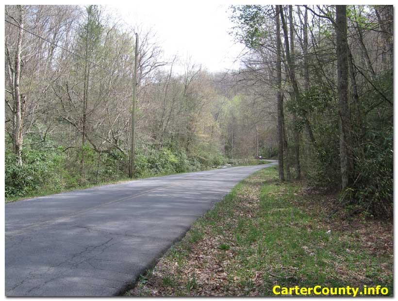
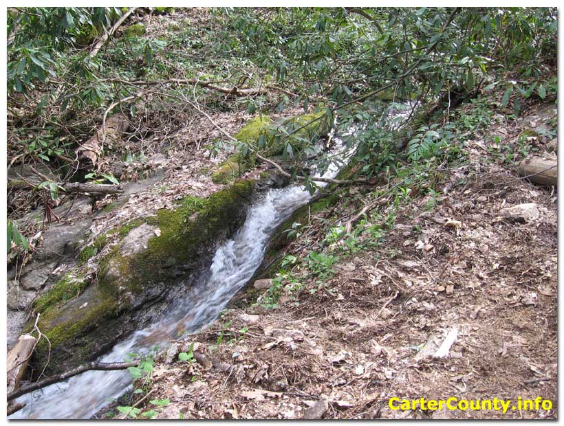
Another Carter County waterfall is Coon Den Falls, known by some in the past as Bear Cave Falls. This is a very high solid rock wall with a minimal stream coming off the edge. It is reached by hiking from Dennis Cove. The trail is easily missed, located along the road between the National Forest campground and the Appy Trail/Laurel Falls trail head. It is 0.6 miles from the trail head near a private property boundary. Laurel Fork runs along the road at this point. There is a culvert under the road where the waterfall stream runs into Laurel Fork. The trail tees into the Appalachian Trail at a point well beyond the falls. The slope up to the falls is moderate. In the winter the tall rock face becomes a wall of ice.
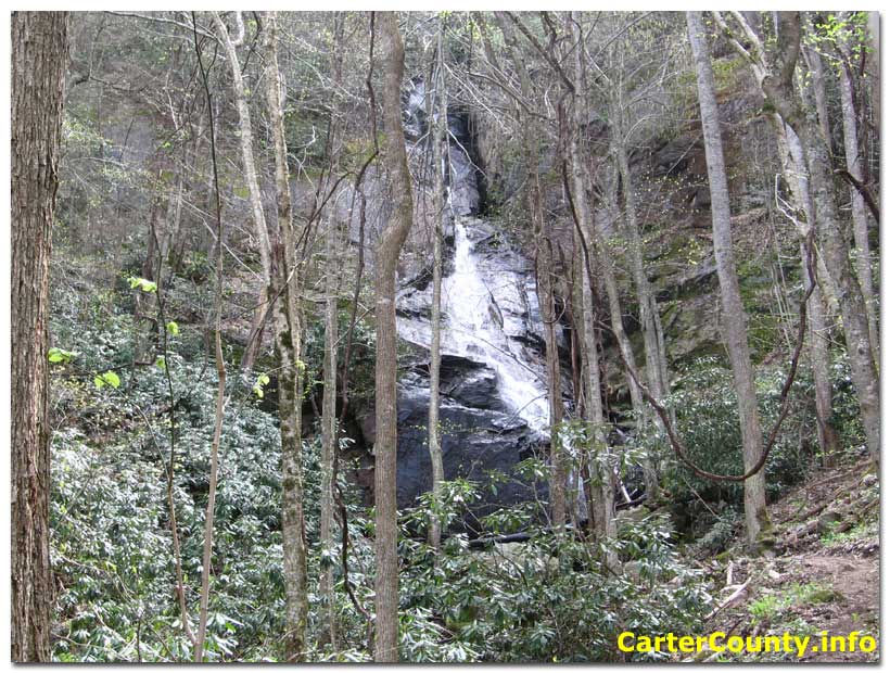
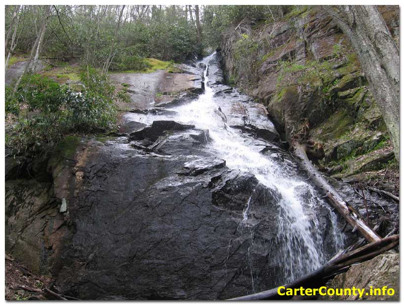
Jones Falls
Jones Falls is a high waterfall with a small stream. Jones Branch runs on to the Elk River near the state line after tumbling through this waterfall. It's located near the Appalachian Trail close to the Buck Mountain area of Carter County. A side trail goes to the falls from the Appy Trail. The coordinates for Jones Falls are N36.20290° W81.98234° according to the map at Topoquest.
Laurel Falls
Laurel Falls is located along the Appalachian Trail between Hampton and Dennis Cove. Also known as Laurel Fork Falls, it is a fairly large waterfall in a deep gorge. It can reached from the trail head in Dennis Cove or from the Laurel Falls trail head in Hampton, located along Laurel Fork on Highway 321. The Hampton trail merges with the Appalachian Trail, which splits off over the mountain toward Watauga Lake. Parts of the trails running along Laurel Fork lie on an old narrow gauge railroad bed. In places there are two parallel trails. The blue blazes indicate the alternative high water trail. The trail from Dennis Cove is shorter and mostly level except for a couple places, like the descent down to the falls. The Hampton trail is much longer, mostly level with a few climbs. It takes about an hour of walking to reach Laurel Falls from Hampton but it is a nice hike. For a detailed view of this hike visit the virtual hike pages.
Other Waterfalls of Laurel Fork
Forest Service Trail 39 runs along the mountain stream water of Laurel Fork above the campground in Dennis Cove. Special trout regulations apply to this section of Laurel Fork above Dennis Cove. The trail head is along the bridge right before the Forest Service campground. It involves several crossings of the creek before reaching these beautiful waterfalls with large splash pools. When the water is low it may be possible to cross without getting wet, but plan for wet crossings. You reach the single fall first after hearing it and tunneling through the rhododendron. The triple cascade is next a short distance up the trail.
The falls may not look large but are loud and impressive up close. It was a sunny August weekday when these photos were taken. We saw one other human on the hike, a friendly trout fisherman. The wet rocks in the third picture are blue from reflecting the sky. The water is cold but feels good on the feet until they get numb, which doesn't take long.
Above these falls the trail runs on to Frog Level. Frog Level is a relatively flat area of land set deep in the mountains. It's another special place. The change in topography to flatness seems odd. The stream becomes calmer and more like a lowland creek. It's the opposite of what might be expected from ascending a mountain stream.


Twisting Falls
Twisting Falls is located in one of the more remote areas of Carter County past Nowhere Ridge. That's right, beyond nowhere. It isn't far from the Avery County North Carolina line on the Elk River near the Poga community. It's reached by taking Poga Road off 321 in the Elk Mills area, to Clawson Road, then to Dark Ridge Road. Park near a barn and then walk a slow steep descent to the falls. The number of injuries at this location is high and it requires great caution. Yet it remains a popular destination for locals and out of town visitors. The coordinates for Twisting Falls are N36.22972° W81.97528° according to the map at Topoquest. View the Google map
Photos | Resources | Weather | Hiking | Roan Mountain | Elizabethton | Scots-Irish | Watauga Lake | Home | Virtual Hike | Wildflowers | Wallpaper | About/Contact
Copyright © CarterCounty.info